

Projects
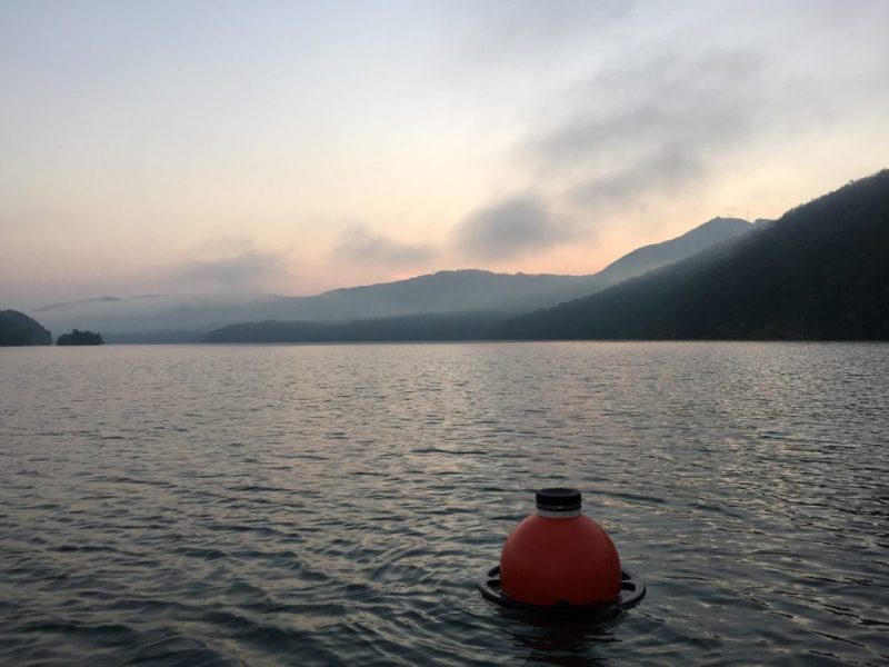
WATER QUALITY
Applying rules of life to forecast emergent behavior of phytoplankton and advance water quality management
Drinking water safety is threatened globally by increasing phytoplankton blooms in lakes and reservoirs, which pose major threats to water quality via harmful toxins, scums, and changes in taste and odor. To improve drinking water management in the face of global change, this project proposes to develop the first automated, real-time lake phytoplankton forecasting system that quantifies uncertainty in water quality predictions. If managers had forecasts of phytoplankton blooms, they could preemptively act to mitigate water quality impairment, such as by adapting water treatment, thereby decreasing costs and improving drinking water safety. The project team plans to integrate cutting-edge lake ecosystem and statistical modeling with new computing capacity to deliver 1 to 35 day-ahead forecasts of phytoplankton blooms to water managers daily for several U.S. lakes. Researchers intend to work with water managers on the forecasting system to generate valuable knowledge about how best to effectively communicate forecasts for improved water resource decision-making.
Funding: National Science Foundation (EF-2318861)
Center personnel: Cayelan Carey, Quinn Thomas, Mary Lofton, Madeline Schreiber, Adrienne Breef-Pilz, Austin Delany, Bobby Grammacy, Ryan Calder

WATER QUALITY
Towards a Global Center for Freshwater Forecasting
Human activities are degrading water quality in lakes and reservoirs around the globe, motivating the urgent need for new approaches to predict future ecosystem and drinking water conditions for management. This Global Centers Track 2 Design project will create the groundwork for developing a global center to provide scientists, managers, and the public in the U.S. and Australia with state-of-the-art, real-time water quality forecasts and decision support tools for lakes and reservoirs. The system will be deployed and tested at four lakes facing a range of climate change threats. Daily forecasts will be generated for a suite of water quality variables and methane emissions, which can inform adaptive monitoring and preemptive management (e.g., divert water from other reservoirs, increase water flows to reduce methane production). Interactive educational materials will be developed and assessed to train managers and community members on freshwater forecasting. A broad community of American and Australian students, academic researchers, government officials, industry representatives, water managers, and the public will be engaged in all center activities, setting the stage for future global engagement via partnerships with multiple international initiatives. The project's overarching goal is to develop the foundation for an international forecasting center that predicts lake and reservoir water quality across the U.S. and Australia to enable climate change adaptation and mitigation.
Funding: National Science Foundation (OISE-2330211)
Center personnel: Cayelan Carey, Quinn Thomas, Freya Olsson
WATER QUALITY
Long-term Research in Environmental Biology
Many ecosystems are exhibiting increased variability as a result of human activities. This environmental variability poses substantial challenges for managers and decision-makers, who can no longer use historical baselines to guide predictions of future ecosystem conditions. Consequently, advancing the capacity to predict the future for a range of physical, chemical, and biological ecosystem variables that influence water quality is paramount for improving resource management. In response to this need, this Long Term Research in Environmental Biology (LTREB) project will support a field monitoring and data-sharing program at two drinking water supply reservoirs. The ecosystem data that will be collected (which will include water temperature, clarity, chemistry, and phytoplankton, among other variables) will be used to generate and evaluate real-time forecasts (predictions of future ecosystem conditions, and the uncertainty associated with them) at daily to annual scales. Forecasting is a powerful approach for quantifying ecological predictability, as it requires using models that represent our best hypotheses about how ecosystems function to predict ecological conditions into the future. Iteratively evaluating these forecasts as new data are collected will reveal which models perform best in different environmental conditions and identify how far into the future different variables can be accurately predicted, from one day to one decade in advance. This project will enable the testing of fundamental hypotheses about the predictability of ecosystems; develop novel workflows for integrating environmental observations into real-time forecasting and data publishing; and broaden the participation of students from underrepresented groups in environmental data science. Moreover, all forecasts will be disseminated to water utilities in real time, enabling their immediate use as decision-making tools for water management.
Funding: National Science Foundation (DEB-2327030)
Center personnel: Cayelan Carey, Quinn Thomas, Madeline Schreiber, Adrienne Breef-Pilz, Austin Delany
Center graduate students:


CYBERINFRASTRUCTURE
DeCODER: Democratized Cyberinfrastructure for Open Discovery to Enable Research)
Scientific research in most scientific fields today involves significant amounts of data as well as software to operate on that data. Furthermore, research increasingly requires data from across a number of sources, perhaps even fields. This is a significant challenge for the scientific community, and better solutions are needed in order to enable new discoveries and accelerate the societal impacts from those discoveries. The approach in this project is to follow in the footsteps of the web and it aims to standardize how scientific data is described, allowing for tools addressing the above challenges, such as search engines for scientific data that not only support discoverability but also facilitate the usage of the data.
The DeCODER project will expand and extend the successful EarthCube GeoCODES platform and community to unify data and tool description and re-use across geoscience domains. Building on the NSF CIF21 vision, the EarthCube program was formed to address the technological challenges surrounding data and software within the geosciences. Through extensive interaction with the community this culminated in two key activities around data discovery and reuse. First, the promotion, refinement, and adoption of schema.org to annotate geosciences metadata within distributed repositories so that datasets can be crawled. Second, the promotion and support for the adoption of notebooks to document, share, and reuse software as peer reviewed scholarly objects. A rallying point around these activities was the GeoCODES platform, which allows communities to stand up instances of scientific search engines specific to their domains, while building a community of geoscience data users and developers and, ultimately, reducing the time to science. This project will leverage this effort in the DeCODER platform to enable similar activities and outcomes across scientific communities. This work will continue the endeavor to support the scientific community in the adoption of schema.org and notebooks, facilitating this by providing DeCODER as an open source resource that can be customized by a given scientific community to create lightweight scientific gateways that bring together relevant distributed resources.
Funding: National Science Foundation (OAC-2209866)
Center personnel: Quinn Thomas, Austin Delany
CYBERINFRASTRUCTURE
FaaSr: Enabling Cloud-native Event-driven Function-as-a-Service Computing Workflows in R
This project develops FaaSr, a new software that will facilitate the programming and deployment of scientific computing applications written in the R language in Function-as-a-Service (FaaS) cloud computing infrastructures. The FaaS model of cloud computing supports dynamic, on-demand execution of computing functions in servers that are automatically provisioned and managed, in a way that is both cost-effective and scalable: users do not need to manage cloud servers (including on-demand scaling) nor pay for idle time of unutilized servers. The FaaS model thus has much potential for reducing the complexity and cost of performing scientific computing in cloud infrastructures. To date, however, FaaS platforms have been primarily designed to support Web-based applications, resulting in a major gap between existing FaaS platforms and the scientific community. This gap is particularly evident in the environmental sciences, where R is the focal programming language. This is because: 1) there is no native support for the R language in FaaS platforms, and 2) each FaaS platform has a unique interface to deploy and manage workflows consisting of multiple functions, thereby creating barriers for users to develop and deploy applications on one or more FaaS platforms. This project bridges this gap by developing open-source software to accelerate the adoption of event-driven FaaS workflows for scientific applications. The FaaSr software will be distributed as an easy-to-install R package and will provide simple interfaces to programmers, while supporting multiple open-source and commercial cloud computing infrastructures. The software will support a wide range of scientific computing applications, in particular those that require dynamic event-driven processing (such as forecasting and continuous data quality) in environmental science subfields (including ecology and biodiversity). Ultimately, the project aims to develop scalable, generalizable, and robust workflows that will advance the capacity, practice, and training opportunities for ecological forecasting, an active area of scientific research poised to significantly increase predictive capacity for effective environmental decision-making and management.
Funding: National Science Foundation (OAC-2311124)
Center personnel: Quinn Thomas, Cayelan Carey, Austin Delany


Water Quality
Building resilience to Earth system hazards: forecasting drinking water quality with real-time integrated catchment modeling
Using simulations of biological and natural processes, this project will generate real-time forecasts of water quality in three reservoirs in Appalachia. Droughts, wildfires, and other hazards alter normal ecosystem processes, which can harm drinking water quality. Water utilities are increasingly concerned about the effects that fires and floods have on water supply reservoirs. Appalachia is experiencing increasing hazards as well as aging infrastructure. Researchers will create the first integrated, real-time system that forecasts future water quality. With this information, water managers may act preemptively to address anticipated changes. This will help decrease costs and improve drinking water safety. Researchers and water managers will work together to produce the forecasting system, which will ensure forecasts are integrated into decision-making. This project will improve STEM education by developing teaching modules on forecasting and reservoir-catchment dynamics for high school and community college students. The improved forecasting that will result from this research project will help reduce the effects of hazards on water quality.
Drinking water quality is threatened globally by changing Earth system hazards. To build resilience in drinking water supplies, water utilities and communities are seeking new predictive tools for guiding catchment and reservoir management decisions. Most water quality research has focused on the influence of hazards on bodies of water separately from their catchments. This project will create a coupled catchment-reservoir forecasting system that will predict future water quality one day to six months prior to treatment. This system will couple terrestrial and freshwater models to fully represent the direct and indirect environmental processes and hazards controlling reservoir water quality. Including the feedback between terrestrial and freshwater ecosystems can help to mitigate increasing risks to drinking water supplies. Researchers and water managers will work together to develop forecast tools, risk models, and data visualizations. This will ensure their broad usability for guiding decision-making. This project will develop teaching materials to improve education for K-12 and community college students. The coupled catchment-reservoir forecasting system developed by this work will be made available globally as a model for drinking water systems.
Funding: National Science Foundation (RISE-2438447) through the Confronting Hazards, Impacts and Risks for a Resilient Planet (CHIRRP) program.
Center Personnel: Cayelan Carey, Quinn Thomas Madeline Schreiber, Adrienne Breef-Pilz, Austin Delany, Ryan Calder
Graduate students:
Partners: Western Virginia Water Authority